Montana commission delays choosing congressional districts
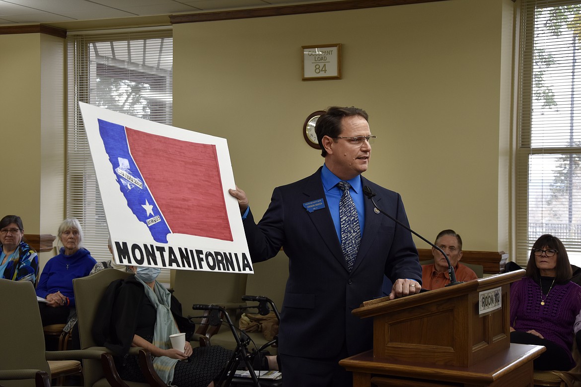
Montana State Rep. Derek Skees, a Republican from Kalispell, holds up a map labeled "Montanifornia" while commenting on proposed maps dividing the state into two congressional districts during a redistricting commission meeting in Helena, Mont. on Saturday, Oct. 30, 2021. Skees used the map to argue against proposals that would keep Democratic stronghold cities Missoula and Bozeman in a western congressional district. (AP Photo/Iris Samuels)
HELENA, Mont. (AP) — Montana's redistricting commission delayed a decision on a map dividing the state into congressional districts after an all-day meeting on Saturday.
The commission failed to reach a consensus on the map proposals they were considering, instead kicking the decision until after receiving more public comments next week as they speed towards a Nov. 14 deadline.
The two Democrats on the commission pushed to approve a map they had proposed that would divide the state into an eastern and western district and place Kalispell, a Republican stronghold in the northwest corner of the state, in the eastern district. That map would give Democrats a fighting shot at winning in the western district despite the state's increasingly red political hue.
But the map faced opposition from Republican members of the commission, who are against placing the mountain community of Kalispell in an eastern district dominated by prairieland and agricultural communities.
Commission Chair Maylinn Smith, who was appointed by the state's Supreme Court, said she could not break the tie in favor of a proposal by Democrats or Republicans before receiving additional public comment on a new proposal submitted by the Republican members of the commission just two days before the meeting.
Smith's decision came after the commission sat through four hours of public comment on Saturday.
The comments fell largely along party lines, with Democrats in favor of district proposals that would create a competitive district in the west that would include Helena, Missoula and Bozeman.
Republicans, on the other hand, argued that the commissioners should not take into account political competitiveness. Such proposals would likely favor Republican candidates in both an eastern and western district.
Democratic state lawmaker Marry Ann Dunwell of Helena said the Republican proposals would "turn congressional races into anointings."
"They will not have to engage with voters or constituents to earn their elections," Dunwell said.
Rep. Derek Skees, a Republican from Kalispell, brought to the commission meeting a map labeled "Montanifornia" with Missoula and Bozeman, both college towns and Democratic strongholds in the western half of the state, marked as "San Fransoola" and "Bozangeles" respectively. He used the prop to argue against proposals that would create a competitive congressional district in the western half of the state.
Skees and others pointed to a law passed by the GOP-dominated state legislature earlier this year that banned the consideration of previous election results when drawing district maps. Under that law, Skees argued that any proposal made by Democrats that would give them a chance as winning a western district is illegal and would be challenged in court.
The map now favored by Republican commissioners keeps Bozeman and Missoula in the western district but places Helena — the blue-tinted state capitol — in an eastern district, a move Democrats say they strongly oppose.
Smith has said that she would like Republicans and Democrats on the commission to reach a consensus but would vote in favor of either the Democratic or Republican proposal if the commissioners cannot find a resolution. The commission has until the middle of November to finalize the districts.
The 2020 Census gave Montana a second congressional district for the first time in 30 years, spurring a redistricting process that had included debate about the changing nature of the state. Booming towns such as Bozeman and Missoula in western Montana provide a contrast to the stagnating agricultural communities in the prairie region that covers the eastern half of the state.