Don't know any better

<p>Little Spar Lake sparkles beneath the Indian Paintbrush decorations of Vertigo Ridge. (Sandy Compton photo)</p>
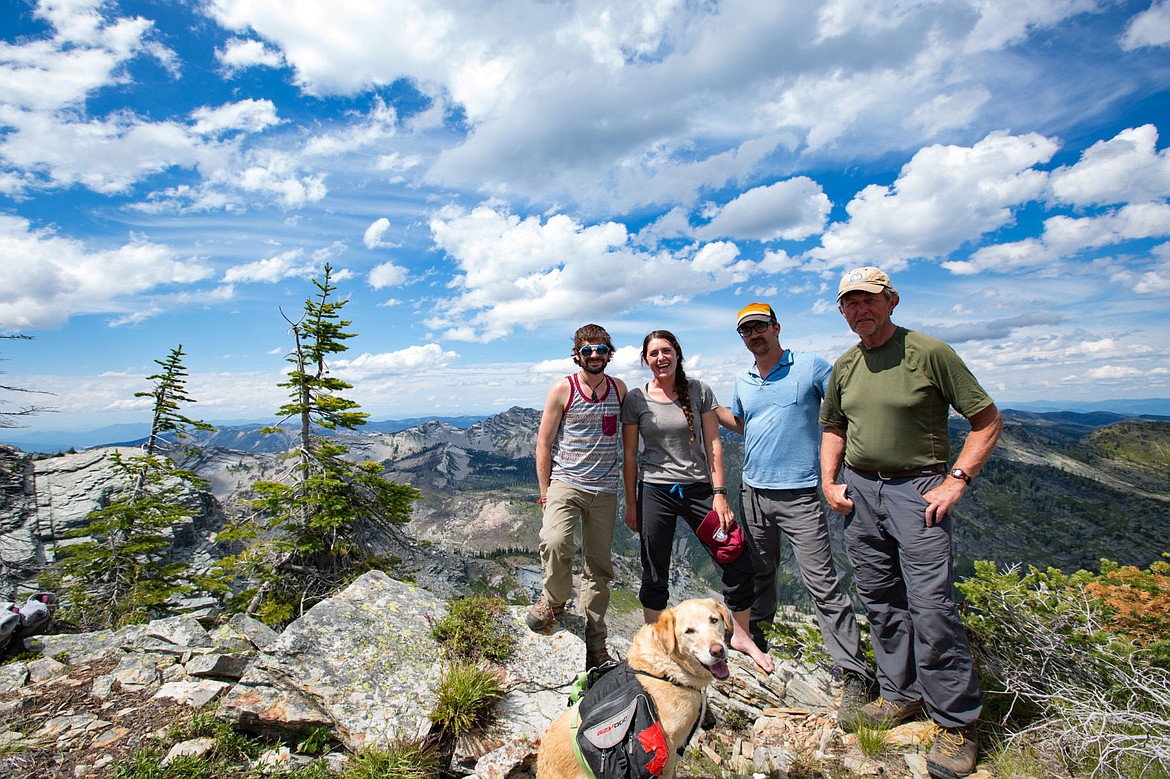
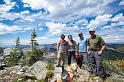
<p>Joe Foster, Lindsay Ashton, Aaron Johnson, Sandy Compton and Golden Canine on the Melissa Crag. (Joe Foster photo)</p>
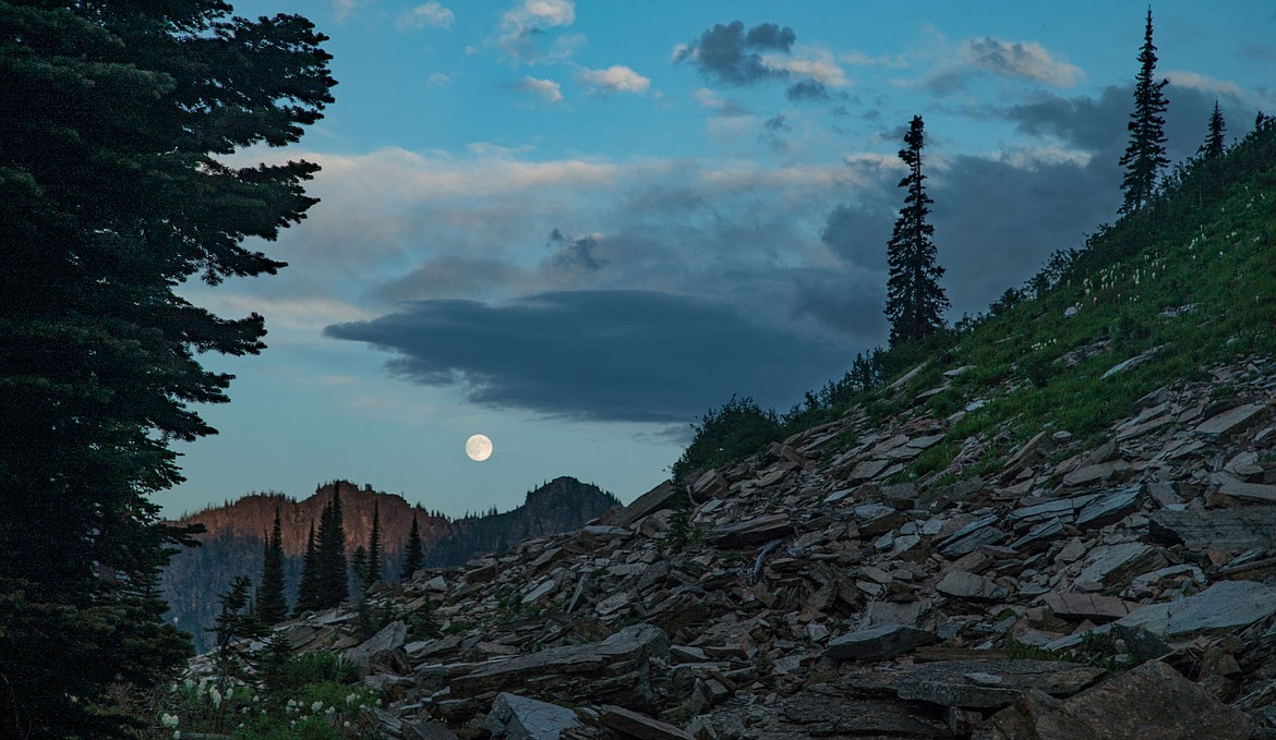
<p>A full moon rises over Sawtooth Mountain in Upper Ross Creek of the proposed Scotchman Peaks Wilderness. (Joe Foster photo)</p>

<p>Art professor Aaron Johnson shows one of his watercolors of the Upper Ross Creek basin. (Joe Foster photo)</p>
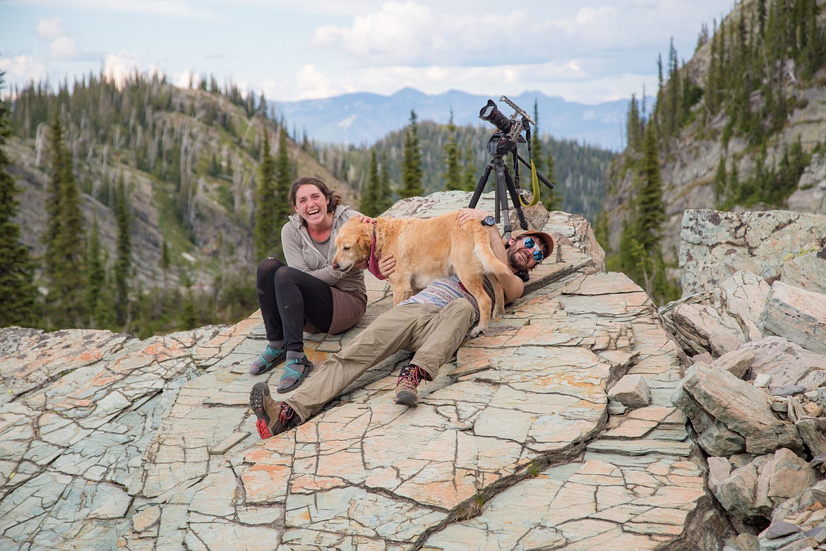
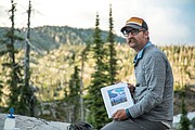
<p>Golden Canine goes for the pin on Joe Foster while Lindsay Ashton looks on. (Sandy Compton photo)</p>


Five-day trek provides display of the Scotchman Peaks Wilderness backcountry
You’d think we’d know better, but we don’t — though two of the five of us had an excuse. Joe Foster and Lindsay Ashton had never been in the backcountry of the proposed Scotchman Peaks wilderness. But, I had. Aaron Johnson had. And Golden Canine (GC, AKA Laddie) had. We knew what we were getting into.
GC doesn’t care. He’s the original off-trail beast; four-foot drive, low center of gravity, thick skin, eternal optimist, loves to travel through wild places. In typical dogged fashion, GC went three times as far as we humans; 50 miles, plus or minus. The humans hauled their packs a mere 17 over the course of five days and four nights. Not a great average, but we took one day off. So we averaged 4.25 miles per day of travel. Smoking right along.
In our defense, the Scotchman Peaks are not easy to get around in. There are few trails, mostly around the edges — the Pilik Ridge complex that centers on Star Peak, overlooking the Clark Fork River in Sanders County; the Scotchman Peak Trail, and a handful of others that begin in Lightning Creek drainage in Bonner County, Idaho. But there are only four trails in the Scotchmans in Lincoln County: Little Spar #143, Spar Peak #324, Ross Creek #142 and South Fork Ross #321.
Generally, my favorite entree into the backcountry is via Ross Creek, but the fires hit #142 and #321 hard last year, and there are a lot of trees down across the trail. So, this year, the Extreme Plein Air started at the Little Spar trailhead and ended in the East Fork of Blue Creek, where there is no official trail. Between the end of #143 at Little Spar Lake and my old blue truck waiting in Blue Creek, we spent a lot of time thinking like elk. Or at least I did.
I determined long ago that where elk can go, humans (and dogs) can. Just not as easily or gracefully. What an elk might do in three bounds and five seconds, humans might do in three false starts, a couple of whacks in the face by tag alder, several semi-bad and one very bad word and a full minute of sweaty struggle. Elk (and GC) have it easy, compared to us, at least when traveling through the wilderness that is the central Scotchmans.
So, why do four otherwise sane people and their faithful canine companion choose to travel through a place that can be as unfriendly as a briar patch? As I said earlier, we don’t really know any better. And then, there is the extreme plein air.
“Plein air” basically means, “in the open air,” and plein air paintings are done outside, generally very quickly. The Extreme Plein Air is an almost-annual off-trail backpack trip during which artists — primarily painters — can practice their craft in a wildly beautiful place, in this case the proposed Scotchman Peaks Wilderness. It began as an extension of the annual Scotchman Peaks Plein Air Paintout, an October gathering of painters from around the Northwest come to paint the Scotchmans; primarily from the outside. But some artists — notably Johnson, from Moscow, Idaho, and Jared Shear of Thompson Falls — wanted to paint from the inside.
Since 2009, there have been seven such trips; visits to places like Savage Basin, Upper Ross Creek, East Fork of Blue Creek, Vertigo Ridge, Melissa Basin and the Crags; exposing the artists to raw and rare beauty in the heart of the Scotchmans.
“Painting in the Scotchmans has changed my life,” said Johnson, who is an adjunct professor of art at the University of Idaho. “Two days after leaving Melissa Basin, I already miss it.”
Leaving — or getting to — Melissa Basin is an exercise in, well, exercise. On our 17 miles, we chalked up 17,000 feet of vertical ascent and decent — and quite a few minutes in unfriendly patches of vegetation. One little stretch — just over a mile — was a climb of 1,600 feet to the Melissa Crag, arranged in such a manner that we could see the top for all the time we were climbing. GC is not the only critter that was panting on that rise. But, with that lovely chunk of creation known as the Scotchman Peaks spread out around us at the top, we knew it was worth it.
My brother Kent and his wife Cindy once wrote a song entitled “I Don’t Know Any Better,” a love song of sorts, about the wonders of living in Western Montana and North Idaho. “If you ask me why I’d live here forever,” it goes, “I’d just have to say I don’t know any better.”
So it is with the Scotchmans. If you ask why I’ll hike there forever, I’ll just have to say I don’t know any better.
Sandy Compton is the program coordinator for Friends of Scotchman Peaks Wilderness. Check out the Extreme Plein Air V. 2016 album on Facebook at www.facebook.com/ScotchmanPeaks.
For more information on photographer Joe Foster, visit www.DappStudios.com.