Fires continue to cause concern
Two fires near Libby have prompted United States Forest Service fire officials to maintain closure orders for part of the Kootenai National Forest.
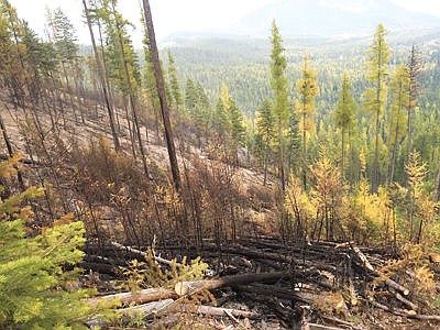
The Klatawa fire, covering more than 5,000 acres continues to burn south and east of Libby. The fire’s spread to areas near Libby’s municipal watershed in the Flower Creek drainage forced a temporary evacuation for residents and businesses in August.
The Smearl fire is a new concern, and suspected to be caused by a campfire left unattended. It is currently burning roughly 180 acres in the Leigh Lake area. Fire crews have reportedly constructed a handline around approximately two-thirds of the perimeter, with 70 percent containment.
“The Klatawa and Smearl fires on the Kootenai National Forest continue to concern fire officials,” Kootenai National Forest public information officer Willie Sykes wrote in a Sunday press release. “The Klatawa fire is currently 5,112 acres and contingency lines are in place to stop the spread. Most of the fire growth is topography driven and with the winds, fire personnel expect to see continued creeping and backing into the handlines that have been constructed. Fire personnel will continue to monitor and reinforce fire lines to keep the fire from spreading toward private property and homes.”
Sykes said the Forest Service has dedicated significant resources to the two fires in recent days, but current and expected conditions in the immediate future are not helping the efforts.
“Minimal precipitation, measuring .13 inch, has been received since Oct. 1 over these fires and wind gusts of up to 24 miles per hour are expected today (Sunday),” Sykes wrote. “Citizens will continue to see smoke and active fire. With the predicted high pressure front developing, inversions will keep smoke in the valley during the week.
“Resources are shared between the Klatawa and Smearl fires. Four helicopters have been working the hot spots and providing air support over the last four days. Resources on the fires include: four 20-person crews, 10 smokejumpers, 18 helitack personnel, three district engines and 10 miscellaneous support personnel.”
The closure order for the Smearl fire area, issued by Forest Supervisor Chris Savage Oct. 9, prohibits access to the area “from the junction of 867 Cherry Creek Road north on 6203 Little Hoodoo Road; along private property boundaries in Sec. 20 and Sec. 29 to Deep Creek; west to the upper end of Deep Creek; from the upper end of Deep Creek south to Bockman Peak; southwest to Snowshoe Peak; southeast to Snowshoe Lakes; Snowshoe Creek east to confluence with Big Cherry Creek; Big Cherry Creek north to the junction of Cherry Creek Road 867 and 6203 Little Hoodoo Road.”
National Forest Service trails 125 Snowshoe Lake Trail and 132 Leigh Lake Trail, along with Leigh Lake Road 4786 and Cherry Creek Road 867 from the junction of Forest Service Road 6203 to the end are also closed until further notice.


